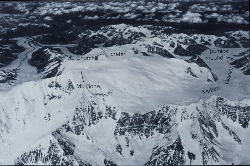
Annotated oblique aerial photograph of Mt. Bona--Mt. Churchill area, view to the northwest, showing the location of the Churchill caldera (labeled "crater"), source of the White River Ash. Also labeled is the "pumice mound" of Lerbekmo and Campbell (1969) adjacent to Klutlan Glacier where the WRA source vent was thought to be located prior to the USGS climb of Churchill in 1990 that discovered extensive pumice (up to 50 cm) and ash deposits and a dacite lava flow on the caldera rim. The photograph is a U.S. Army--Air Force trimetrogon oblique photograph taken June 16, 1948. Mt. Churchill is 15,638 ft (4,766 m); Mt Bona is 16,420 ft (5,005 m). The summit of Mt. Churchill forms the west wall of the caldera, which is 4.2 x 2.7 km in dimension.
Volcano(es): Churchill, Mt
Photographer: US Army-Air Force
URL: avo.alaska.edu/image/view/57801
Please cite the photographer when using this image.
Full Resolution.