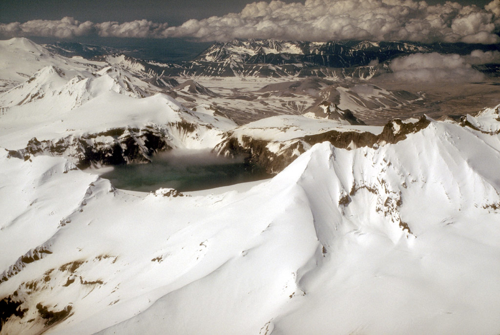
Katmai Caldera, a collapse feature that formed during the catastrophic eruption of nearby Novarupta volcano in June, 1912, is a steep-walled, 1.5-km (1 mi)-diameter crater that truncates a formerly 2,290-m (7,513 ft)-high stratovolcano. The caldera is partially filled by a blue-green lake about 250 m (820 ft) deep. The lake level was still rising when last measured in the mid-1970's. The multiple peaks of Trident Volcano are at top left. The lava dome of Novarupta volcano, which marks the site of the 1912 eruption, is visible at top, center. Photograph by C. Neal, U.S. Geological Survey, June 4, 1990.
Date: Jun 4th, 1990
Volcano(es): Katmai Novarupta Trident
Photographer: Neal, C. A.
URL: avo.alaska.edu/image/view/364
Image courtesy of AVO / U.S. Geological Survey.Volcano(es): Katmai Novarupta Trident
Photographer: Neal, C. A.
URL: avo.alaska.edu/image/view/364
Please cite the photographer and the Alaska Volcano Observatory/U.S. Geological Survey when using this image.
Full Resolution.